The
Travelogues of Diane and Dave
|
The
Travelogues of Diane and Dave
|
|||
|
|
|
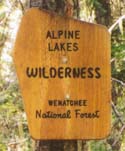
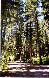
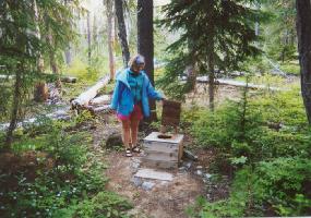
By the time we drove out of the Seattle morning traffic, shopped in Cle Elem for a few last minute supplies (unimportant stuff like stove fuel, maps, mosquito headnets and trailhead pass) we ended up with a late noon-time start from the Salmon la Sac trailhead. There were numerous trails leaving the trailhead, but they were well marked and we soon found our way hiking up the Pollalie Ridge Trail, and I do mean UP the trail. The trail had nominal, if any switchbacks. It was a long, steady, constant, grinding uphill for the next 4 hrs/4 miles to Diamond Lake, which was a beautiful little jewel of a lake nestled in a forested saddle on Pollalie Ridge. The water was shallow, warm enough for swimming and crystal clear. You could see the fish at the bottom of the lake 20 feet from the shoreline. A mother duck and her cute young ducklings paddled slowly around the lake feeding. It was a lovely picture of quiet, beauty, peace and serenity. Except, . . . . we had to cover every square inch of our flesh to protect it from the ravenous hordes of stinkin', rotten, blood-thirsty mosquitoes that constantly assaulted us. While I rested my butt on a tree stump and fed the mosquitoes, Diane wandered around the north shore of the lake and found a campsite near the lake outlet that was slightly elevated, captured a slight breeze, and was "slightly" less buggy. That evening after dinner, we reassessed the rest of our planned route.
There was no way we wanted a repeat of our 1999 trip to Yosemite where
we spent 7 days out in the wilderness donating blood everyday to the local
mosquito blood bank. We decided on a shorter route to Waptus Lake where
we'd spend tomorrow night along the shores of Waptus Lake. At that point
we'd have another reassessment as to whether we'd bag the rest of the
trip or stay at Waptus Lake and do a day hike up to Spade Lake.
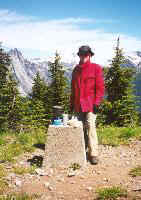
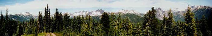
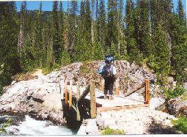
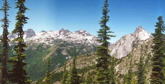
Our first panoramic vista along Pollali Ridge! Taken near the site of the old fire tower. We finished our brunch as fast as we could, packed up and continued on to the Waptus Pass Trail junction. Halfway to the junction we ran into a strange "apparition" of a young man. He was clad only in a pair of shorts and soft leather moccasins. All he carried was what looked like a plastic toy bow and one arrow and a blanket/bedroll slung over one shoulder. Sticking out of the bedroll was a very heavy looking hatchet and what appeared to be a Bible and stuck down in the front of his shorts was a large Bowie knife. His arms and shoulders were covered with mosquito bites. He carried no map and asked us for directions to the Salmon la Sac trailhead. After speaking with him for a short while and giving him a trail report of what was ahead of him, we parted company and continued along the trail. We often wonder how he fared and how he came to be backpacking in an unfamiliar area with no map and such nominal, rudimentary gear. The Waptus Pass Trail down to Waptus Lake was a rather steep descent following Quick Creek with a few nice views of the rocky gorge and creek. Again what few switchbacks there were along the trail, were nominal. We eventually arrived at the lake shoreline. To get to the other side of the lake where the campsites were, it was about another mile hike down to the footbridge across the Waptus River and then another mile back up to the shoreline campsites. We had read that these campsites were normally mobbed, but there wasn't a sole there when we arrived. We picked the first site we saw and took a quick refreshing skinny-dip in the lake before we set up camp and ate. While setting up camp 2 other guys arrived. They found a much nicer site further along the shore that had a lot more privacy. Something to remember for the next time. The lake was large and there was a beautiful, refreshing breeze off the lake that kept the few bugs that were present out of our way. Later in the evening when the breeze calmed, the bugs were still not bad. What a pleasant relief from the plagues on Pollalie Ridge! That evening we decided to attempt the ascent to Spade Lake. According
to the guidebook, it was a steep 4 mile climb to the lake so we decided
to leave our campsite set up at Waptus Lake, take one pack with a few
essentials and make a day hike out of it.
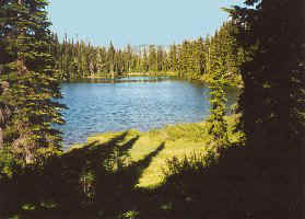
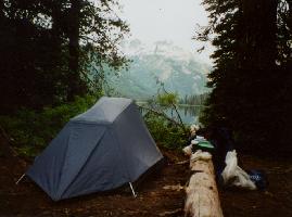
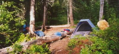
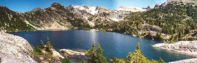
Here's our site on the shores of Waptus Lake.
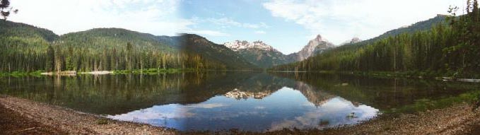
Here's a better view of Waptus Lake, looking northwestward from our lakeside campsite. Day 3: We got up early and set off for Spade Lake before 7 am. The guidebook had recommended an early start since the trail was difficult and near the top it was exposed to the sun, a recommendation we later learned was very good. It was an easy 1 mile walk along the shoreline to the start of the Spade Lake trail. Then it was STRAIGHT UP the steep mountainside thru a fairly dense forest with several blowdowns across the trail. In several places the trail was overgrown and difficult to follow. After about 2 miles the trail turned west and started to follow the contour with a few interruptions of steep ascents and descents until we finally arrived at Spade Lake. The ascent took us about 4.5 hours, but it was well worth it. The views along the last two miles of the trail were fantastic. We had a good view of Mt. Rainier way off in the distance behind another range of mountains. We also had real good views of Summit Chief and Bear's Breast mountains at the end of Waptus Lake, which was also visible down in the valley. We were glad we hadn't carried our full packs up the steep trail. There were very few campsites around Spade Lake. We only found 2 places suitable for setting up a tent. The ground is very rocky with the areas in-between covered with fragile tundra growth. While I relaxed and stretched out on a rock in the sun, Diane went off exploring and found the lake outlet. Then it was time for a quick skinny-dip in the VERY cold water. I got in up to my ankles, Diane got in all the way. I have no idea how she can tolerate swimming in such cold water. After lunch we packed up and began the long descent back to our campsite at Waptus Lake. Along the way we ran into the two guys we had left back at Waptus Lake earlier. They were slowly backpacking up to Spade Lake will full packs in the heat of the midday sun. Back at Waptus Lake, 3 hours later, we had the place to ourselves again with time for another quick dip before supper.
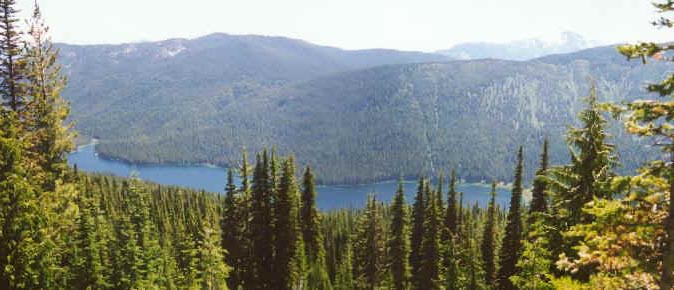
^ An aerial view of Waptus Lake from the
trail to Spade Lake.
^ Summit Chief and Bear's Breast mountains from the Spade Lake trail.
^ The lovely, tranquil and freezing cold water of Spade Lake. Day 4: This morning we got up and decided to head back out to the Salmon la Sac trailhead. According to the map it should be an easy, mostly flat 8.5 mile walk thru the woods occasionally skirting the Waptus River. The hike turned out to be as advertised, a relatively easy walk thru the woods, no dramatic mountain views, just a few mildly scenic shots of the Waptus River as the trail wound along its shore. After about 4 hours we found ourselves back at the car. We enjoyed a quick dip in the Cooper River alongside the parking lot and then changed into clean clothes for the trip home. We noticed that the trailhead served as an afternoon "hangout" for the local youth as there was a very large boulder in the Cooper River nearby that provided a 15 foot jump into a very deep pool. It didn't appear that they would be any kind of threat to the backpacker cars at the trailhead as the guys were more interested in checking out the girls and vice-a-versa while jumping off the boulder into the river! On the way back to Seattle, we stopped off in Cle Elum for supper at the Mexican restaurant El Caporal located right on the main street thru town. It was a very nice busy family restaurant with good food. General Comments Flora and Fauna:We saw many wildflowers while backpacking. For a few shots of the many flowers, visit our Alpine Lakes Wildflower Page. References:We found the Mountaineer's guidebook "100 Hikes In the Alpine Lakes" to be helpful in describing the trails. We also had a map of the entire Alpine Lakes Wilderness which was very helpful in finding and planning our route. Northwest Trail Passes:Before you drive all the way out to Salmon la Sac trailhead, make sure you stop off at the regional National Forest office in Cle Elum. It's just on the outskirts of town on the road to Salmon la Sac. The pass costs $6 a day or $30 for the year, hangs from your rearview mirror and lets you park at the trailheads. A good percentage of the funds goes towards trail maintenance. The one trail pass is good for both Washington and Oregon. Local roads:The roads out to and around Salmon la Sac were dirt/gravel and in very
good condition. Easily passable in a regular car, you could do 40 mph.
When we were there, they were rather dry and therefore dusty.
|
||||||||||||||
|
|
|
|
|
|
last revised
:
February 13, 2006
|