The
Travelogues of Diane and Dave
|
The
Travelogues of Diane and Dave
|
|||
|
|
Chapter 6: McCart Fire Lookout and the Bitterroot Valley |
|
|
||||||||||||||
|
||||||||||||||
|
|
||||||||||||||
|
|
|
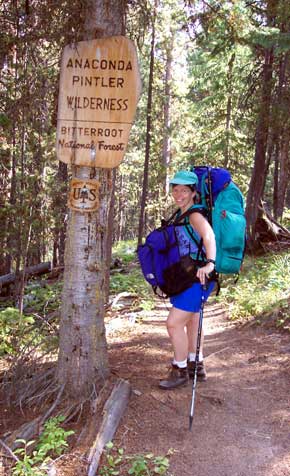
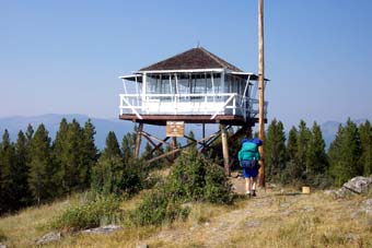
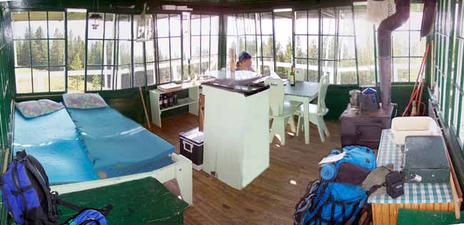
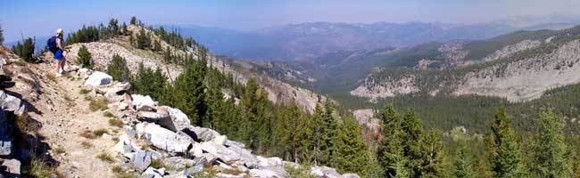
From Ennis we drove about 193 miles to the town of Sula via Chief Joseph Pass in the southwest corner of Montana. The pass is right on the border of Montana and Idaho so we drove about a half mile south into Idaho and then turned around and went back so that we could say we've been in Idaho. Heading north on Highway 93 we entered the southern end of the Bitterroot Valley. The first "town" we came to was Sula. Let me tell you, the town of Sula isn't much. All there is on the highway is a general store/restaurant/gas station all rolled into one building. That's Sula! The town's post office is about 2 miles back up a side valley. At Sula we got off the highway and headed east up a side valley to the McCart Lookout, our first Forest Service lookout tower. The road started out paved but the last 5.5 miles up the mountain was a single lane dirt/gravel fire road. The road was in very good condition and was easily managed in our rental car. The road ended at the Johnson Peak Trail trailhead. From there it was a moderate 1.5 mile hike up to the lookout tower. The tower was very well equipped with a wood burning stove, a two-burner Coleman stove, a Coleman lantern, some cooking pots and pans, and some dishes and silverware. The only thing missing was drinking water which we had to carry up in our packs, a total of about 4 gallons of very heavy water. The lookout was a 14 foot square "cabin" up on 10 foot stilts. It reminded us of a PATC (Potomac Appalachian Trail Club) cabin, only with a whole lot more windows. We spent the next two nights there.
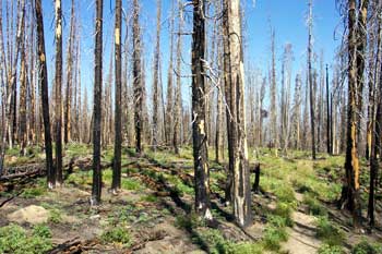
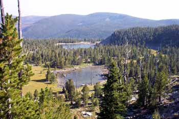
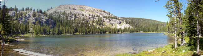
On the day in-between we took a __ mile round-trip day hike up to Johnson Peak and then continued on down to the Continental Divide Trail. We followed that trail east for about __ miles to _________ Lake where we enjoyed our lunch and a quick dip. Well, . . . actually only Diane dipped, I waded. As usual, the water was too cold for me :-(. It was a really nice hike except for the first 2 miles or so which was thru an area of forest that had been burned several years ago. Hiking thru a forest of dead, charred trees is not real scenic to me.
After our brief wonderful stay at McCart Lookout we drove back out to Highway 93 and continued north thru the Bitterroot Valley. As we drove further north, the sky got hazier and smokier from the forest fires surrounding Missoula, located at the northern end of the valley. We stopped at the small town of Stevensville, about 30 miles south of Missoula, where we had reservations at "Haus Rustika", a B&B operated by Grace and Will Werner. They were great hosts and we spent a long time talking with them over breakfast the next day. Fortunately, they had some photos of the local surrounding snow capped mountains that showed us the views we were missing due to the fire smoke. They also had a great contour map of the western half of Montana covering nearly one whole wall in their house. It gave us guests a good perspective of the state's geography. The next day on our way north thru Missoula, we stopped off at the Smoke Jumpers Center located at the Missoula International Airport. This is their main headquarters where they stock all their equipment, repair and repack all their parachutes, maintain their fleet of aircraft and take off for their missions anywhere in the northwest US. Normally the center would have been closed for the season the weekend we were there, but with all the local forest fire activity, there were firefighters from all corners of the US nearby and they kept the center open for them to get tours before they went back to their home state. After leaving the Center, we continued heading northwest towards St Regis and our second rental lookout tower called UpUp40. |
||||||||||||
|
|
||||||||||||||
|
|
|
|
last revised
:
February 12, 2006
|