The
Travelogues of Diane and Dave
|
The
Travelogues of Diane and Dave
|
|||
|
|
Chapter 2 |
|
|
|
|
||||||||||||
|
|
||||||||||||
|
|
|
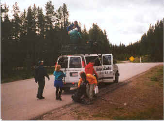
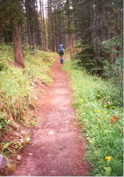
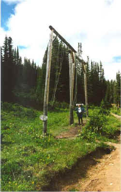
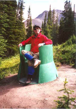
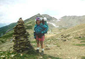
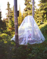
Day 3 On Monday we started our first backpack, a four-day, 27 mile hike along the Skyline Trail. We had to get up early and drive to Signal Mountain where we left our rental car at the western trailhead. There we were met by the Maligne Lake Shuttle Service, which shuttled us about 45 miles to the eastern trailhead near Maligne Lake. The shuttle driver off loaded our packs and took off, leaving us alone to ponder the trail ahead. After making some quick repairs to my pack (a plastic strap buckle had broken on the shuttle van) we took off. The trail started by gently meandering through a thick Lodgepole Pine forest. We were imperceptibly climbing. After a while we started breaking out above tree line and the views of the surrounding mountain ranges got better and better with every foot of ascent. We passed through Little Shovel Pass and entered Snowbowl meadow. The colorful wild flowers were doing their best to impress us. After a few more miles we arrived at our first night’s campground, #147;Snowbowl Campground”. The Canadian Park Service requires backpackers to stay in organized backcountry campgrounds, not like the US Park Service where you can camp anywhere in a national park. But on the plus side, they provide bear poles to hang your food (required in bear country), picnic tables to eat on, smooth flat tent pads and a “latrine”. The latrine, however, left much to be desired for privacy. A Canadian Park Service latrine consists of a green plastic “throne” you sit on with a low, waist-high privacy wall around it and no roof or door (see photo below of a Canadian “green throne”). Fortunately, you always had the option of going out in the woods and finding a private tree :-).
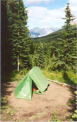
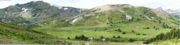
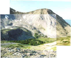
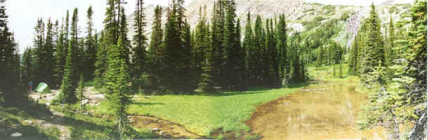
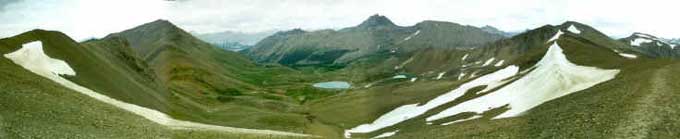
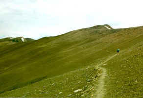
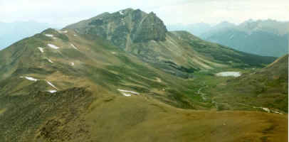
Day 4 Tuesday, we packed up and continued along the trail through more flowery meadows on our way to Big Shovel Pass. On the other side of the pass, the flowery meadows ceased and we entered an area that was more like a moonscape, just barren rock and loose talus and occasional snowfields. Up ahead of us loomed “the Notch”; a high, steep pass. Just before we reached the notch though, we had to turn left, leave the trail, and descend into a side valley for Curator Campground, our stop for this evening. The campground was empty, so we were able to take the only nice site in the campground. We camped beside a small creek and tranquil pond with a view of a waterfall in the distance. We had several trees for a buffer between us and the remaining sites, which were right on top of each other. Just below us in the valley, was Shovel Pass Lodge, a commercial horse ranch/lodge. The operator ran organized horseback trips into their lodge where they provided room and board in small cabins and you were free to do day hikes during your stay.
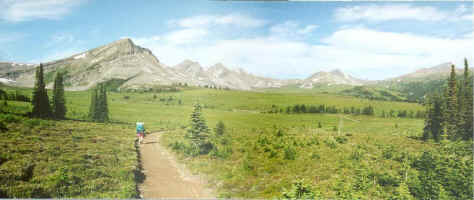
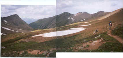
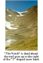
Day 5 On Wednesday, we had to climb back up out of the valley (UUGH !) and
pick up the trail again. We had about a � mile flat stretch of trail before
we started our ascent of the notch. While it looked imposing, the steep
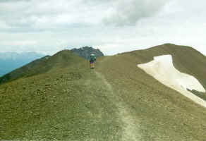
switchbacks up to the top of the pass didn’t take long. Once
The view ahead, along the exposed ridge. There was no protection from the elements.
Day 6 Thursday we hiked out the remaining 5 miles along a very boring fire road that gently lead downhill back to our car. We quick drove back to Maligne Lake and the trailhead we had left a few days ago to quickly check out the lake and eat a quick brunch. They had tourist boat rides on the lake but we declined since we wanted to stop off in Jasper and do some quick laundry before we drove south to Sunwapta Falls Resort where we had lodging reservations for the evening. |
||||||||||
|
|
||||||||||||
|
|
|
|
last revised
:
February 18, 2006
|