The
Travelogues of Diane and Dave
|
The
Travelogues of Diane and Dave
|
|||
|
|
Chapter 5 |
|
|
|
|
||||||||
|
|
||||||||
|
|
|
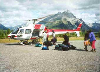
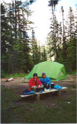
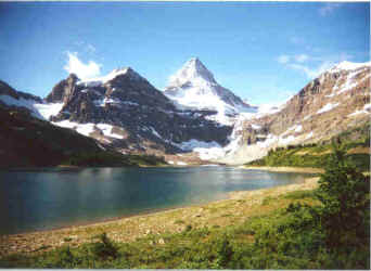
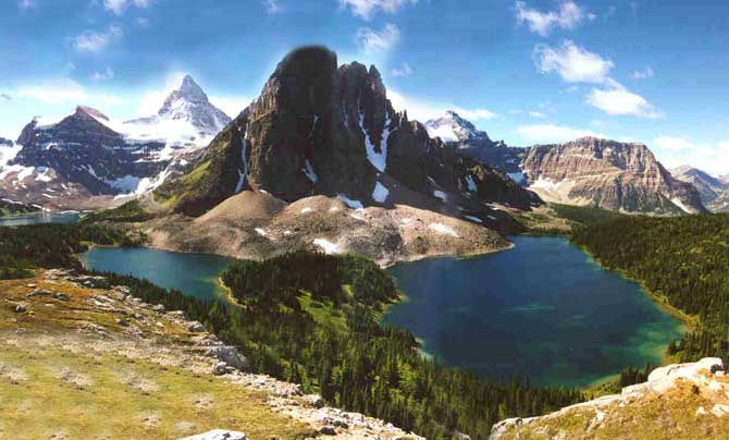
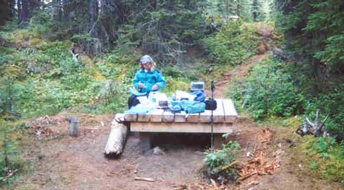
Day 9 On Sunday morning we drove south to Canmore and the start of our second backpack in Mt. Assiniboine Provincial Park. Behind the town of Canmore we picked up a gravel road, which we followed for 45 minutes up a long valley way back into the mountains behind Canmore to Mount Shark Heliport. It was here that we picked up our helicopter ride into Mt. Assiniboine Lodge. We had heard that the hike into the lodge was a boring 16-mile hike along a viewless, plain, boring fire road so we chose to take the helicopter in. However, the helicopter was expensive ($100 Canadian per person one way) so we compromised, helicopter in, and backpack out. We figured the route out would be primarily downhill and our packs would be lighter since most of our food would have been consumed. The Mt. Assiniboine Lodge is a commercial establishment that features lodging and meals. It’s situated on the shore of Lake Magog at the foot of Mt. Assiniboine. It’s very nice in a simple, rustic kind of way. It’s also expensive. Considering that all of their supplies have to be flown in, it’s not surprising. We chose the Lake Magog Campground run by Parks Canada for our lodging instead. The chopper ride in to the lodge took about 10 minutes. The landscape below us was still frosted from the early morning frost and light snow shower. While the snow was slowly melting with the rising sun, the sky still had a threatening look to it. After off loading our gear from the chopper, we hefted our packs on our backs and took off along the one-mile trail to the Lake Magog Campground. There we found a great campsite up the hillside, in the back, shielded from the other sites by a row of trees and with our own personal view of Mt. Assiniboine. We scavenged some tree stumps and flat boards from other empty sites and built a “dining room table” for ourselves. We situated the table so that we had a view of the mountain while we ate. This lovely site was our home for the next three nights and two days. There were about 30 sites in the campground, many of them clustered together in small open fields.While we were there, only about half a dozen sites were occupied. Based on a sampling of the registration tags left at the campsites, it had been very full for the previous two-day weekend.
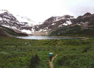
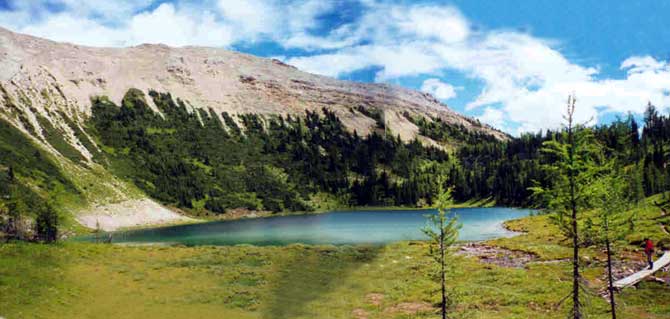
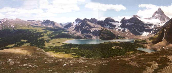
Day 10 Monday dawned cool and clear, not a cloud in site, just clear, sunny, royal blue sky !! We took the trail around the backside of the campground to Sunburst and Cerulean Lakes. They were beautiful, cold, crystal clear lakes surrounded by rocky peaks and dense pine forests. From the lakes we climbed up to the Nublet, a small peak. From there we could overlook all the local lakes, mountains and valleys. From the Nublet we could have rock scrambled up further to the Nub, which was a peak a few hundred feet higher than the Nublet, but we wanted to get back down into the valley and check out nearby Elizabeth Lake. If we had known better, we could have ascended the Nub, enjoyed better views, then continued over the far side of the Nub peak, hiked along the ridge and then descended the ridge via a dry ravine down to Elizabeth Lake. We learned of this route by watching a guided group of day hikers from the lodge as they followed the route. Instead, we descended Nublet down to Elizabeth Lake. From Elizabeth Lake we continued on over towards Ferro Pass. The trail was somewhat boring, being in a dense pine forest with no mountain views, plus, halfway there, we realized that we had mis-calculated our anticipated round trip mileage, (our total was going to be 4 miles longer than we had wanted to do), so we turned around and headed back home.
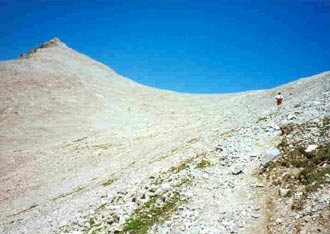
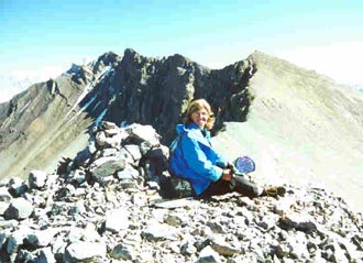
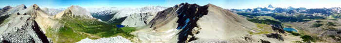
Day 11 Tuesday, we had the second of our two best day hikes in the Canadian Rockies. From our campsite, we headed north, past the lodge, through Og Meadows, towards Og Pass and Windy Ridge. We thought we might get nice views east through Og Pass, but the pass was a disappointment. It was a nice meadowy pass with it’s own little lake, but there were no views. We quickly snacked, left the pass (the horse flies were getting really bad), and continued on up to Windy Ridge. It was an easy walk up gentle, rocky, talus switchbacks to the ridge. As we crested Windy Ridge the view into the valley beyond was breathtaking. The ridge dropped off in a cliff on the other side, dropping down at least a 1,000 feet. Off to our left was a small un-named talus covered peak, which we ascended. From there we had a STUPENDOUS 360-degree view! The grandeur, the magnitude, the depth and breadth of the view are beyond my words. The top of the peak was a rocky platform about as big as a dining room table. All around us, the peak sloped steeply down many hundreds of rocky feet to the valleys below. This was definitely not a place for agoraphobics or anyone unsteady on their feet! The weather was perfect. The sky was clear blue, not a cloud in sight! There was a rock cairn on the top of the peak that held a glass Mason jar containing a notebook in which we could record our accomplishment and write some notes. After enjoying the peak at Windy Ridge, we quietly returned to our camp. Nothing we could say or see could top the view and experience we had just enjoyed on the top of Windy Ridge peak.
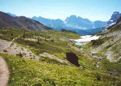
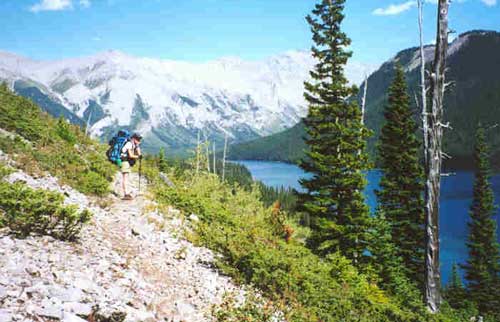
Day 12 Wednesday morning, we broke camp and started our 2-day backpack out to the Mt. Shark trailhead. We had the choice of hiking out through Assiniboine Pass or through Wonder Pass. We chose Wonder since we had helicoptered in through Assiniboine. The trail led gently uphill to Wonder Pass where we took a "short?" side trail leading to a scenic overlook. From there, we got a good view of the valley, mountains and glaciers beyond and of Gloria, Terrapin, and Marvel Lakes below. We would definitely recommend taking the side trail! After the Pass, it was a long set of switchbacks down into the valley and then an exorable long hike along the shore of Marvel Lake where the trail was out in the open and very rough and rocky on our hot, tired feet. We were very glad to reach Marvel Lake campground where we stopped for the day. We set up camp at a lovely site near a rushing stream. Later in the evening, after supper, we heard a loud splash and saw a large fountain of water rise from the stream as something large fell into the water. We couldn’t see anything that might have cause the splash, neither rock, nor tree, nor animal. However, it spooked us enough that we unstaked the tent, picked it up (love those freestanding tents!), and carried it through the woods to a site further from the stream. Being further from the stream, it was quieter and we figured it would be easier to hear any animals approaching our site during the night.
Day 13 Thursday, we got up early and started the long 8-mile trek out on the boring, viewless fire road. Diane appreciated the soft pine mulch surface of the road. It was a lot easier on the feet! That night, we stayed at The Stockade, a group of small but comfortable cabins located in the little town of Harvie Heights just outside of Canmore. Our cabin was a small one-bedroom unit with a full bath and front deck, complete with colorful flower boxes. |
||||||
|
|
||||||||
|
|
|
|
last revised
:
February 18, 2006
|